 The National Oceanic and Atmospheric Administration published its 2009 hurricane predictions interpreted by some to be “busy” and others as “normal.” Top weather forecasters on the federal level announced that the tropics are likely to experience an active storm season, stirring up between 11 – 14 storms with 6 -8 of them becoming full hurricanes. This is not quite as active as last year’s storm season which produced 16 named storms, 8 of them hurricanes and 5 of those major hurricanes. Florida, for its part, only had to deal with one storm, Fay, and the Gulf of Mexico remained relatively unharmed.
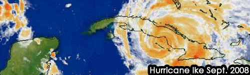
The hurricane affect on the travel season is ambiguous at best. Any city in the path of a Hurricane or tropical storm instantly becomes America’s most avoided destination. Even small tropical storms, a full week away from landfall where Panama City Beach sits somewhere within a 300 mile-wide landing cone, could detour potential tourist to other vacation areas. Travel by air during hurricane warnings is usually halted and driving into a potential storm isn’t necessarily safe. Vacations are canceled or postponed and economically the shift can be staggering. In a post-Katrina 2006 survey by Manugistics Group Inc., results found that one quarter of Americans say they would cancel Florida travel plans because of the hurricanes. The survey also said up to 3.4 million hotel room-nights could be canceled or avoided during the remainder of the year.
On the other hand, despite the devastation wreaked by hurricanes in recent years, thousands of intrepid travelers will be making their way to hurricane zones like Panama City Beach, lured by cheap airfares and accommodation rates. Many travelers are willing to risk encountering a storm during their vacation — especially if their hotel or condo destination offers a hurricane guarantee. Case in point, the very same Manugistics Group Inc survey also found that one third of American adults said the hurricanes would not affect travel plans.
The Panama City Beach’s TDC, CVB and the majority of the private sector have spent loads of money marketing this year’s summer season expected to be bigger than the last two years. With Panama City Beach’s new image being showcased all over the south, the buzz about the city may be at its highest point, so high that the only thing that can bring it down is a hurricane. Still, PCB has endured many hurricanes and businesses remain stalwart. Billy Alam, General Manager of the beach front Days Inn, says, “I’m not worried. You just have to be prepared.”
Preparation was the talk of the NOAA forecast news conference. Commerce Secretary Gary Locke told reporters, ”Our plan today is simple: We want the public to be ready for this year’s season,” Locke was accompanied by NOAA Administrator Jane Lubchenco and Bill Read, NOAA’s National Hurricane Center director. Bill Read added, “Hurricane season in upon us. We need to communicate down to the personal level, preparedness, now is the time.”
NOAA officials said the forecast will be updated in August, normally the busiest part of hurricane season.
The first four storms of the year to come out of the Atlantic, Caribbean or the Gulf of Mexico have already been named, Ana, Bill, Claudette and Danny. For a summer season that is set to be a lucrative one for Panama City Beach businesses, let’s hope we don’t get to meet Ana, Bill, Claudette or Danny face to debri-swirling face.